
Mapping the Nation: History and Cartography in Nineteenth-Century America - Susan Schulten
300,39 lei333,77 lei
Ai ajuns la un produs concret. Îți pot spune rapid dacă merită, ce avantaje are și ce alternative similare găsești mai ușor.
Pe scurt: \n \nIn the nineteenth century, Americans began to use maps in radically new ways. For the first time, medical men mapped diseases to understand and prevent epidemics, natural scientists mapped climate and rainfall to u…
- Îți pot recomanda rapid produse similare sau alternative mai bune din aceeași zonă.
- Dacă nu e exact ce cauți, putem restrânge imediat opțiunile în funcție de preț, utilizare sau stil.
- Poți deschide oferta din magazin sau poți continua aici conversația pentru comparații și recomandări.
Detalii despre produs
Produse similare pe care le poți explora

Mutual Aid: An Illuminated Factor of Evolution - Peter Kropotkin
Gats: - \nOakland-based artist GATS (Graffiti Against the System) is an internationally renowned graffiti artist with w…
187,86 lei 208,73 lei

The Origins of the New: Novelty and Innovation in the History of Life, Culture, and Technology - Douglas H. Erwin
Douglas H. Erwin is a leading paleobiologist whose books include Extinction: How Life on Earth Nearly Ended 250 Million…
279,07 lei 310,08 lei

Life is a Miracle: An Essay Against Modern Superstition - Wendell Berry
In Life Is a Miracle, the devotion of science to the quantitative and reductionist world is measured against the myster…
103,36 lei 114,84 lei

Your Stone Age Brain in the Screen Age: Coping with Digital Distraction and Sensory Overload - Richard E. Cytowic
An award-winning neurologist on the Stone-Age roots of our screen addictions, and what to do about them. \nThe human br…
207,36 lei 230,40 lei
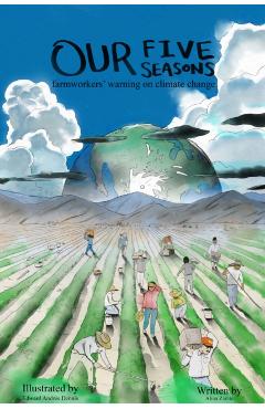
Our Five Seasons: Farmworkers' Warning on Climate Change - Alina Zárate
From the Fields, Sounding the Alarm of Climate Change Our Five Seasons offers powerful, first-hand accounts of what is…
98,21 lei 109,12 lei

Einstein and the Quantum Revolutions - Alain Aspect
Kaiser, David: - David Kaiser is the Germeshausen Professor of the History of Science and professor of physics at the M…
105,30 lei 117,00 lei