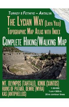
The Lycian Way (Likia Yolu) Topographic Map Atlas with Index 1: 50000 Complete Hiking/Walking Map Turkey Fethiye - Antalya Mt. Olympos (Tahtali), Kini - Sergio Mazitto
104,27 lei115,86 lei
Ai ajuns la un produs concret. Îți pot spune rapid dacă merită, ce avantaje are și ce alternative similare găsești mai ușor.
Pe scurt: Detailed topographic map 1:50.000 & 20 meter contours for hiking and trekking, printed as an atlas book (with overlapping pages). \nComplete map of a popular version of the famous Lycian Way hiking trail in southwest Tu…
- Îți pot recomanda rapid produse similare sau alternative mai bune din aceeași zonă.
- Dacă nu e exact ce cauți, putem restrânge imediat opțiunile în funcție de preț, utilizare sau stil.
- Poți deschide oferta din magazin sau poți continua aici conversația pentru comparații și recomandări.
Detalii despre produs
Produse similare pe care le poți explora
Backpacking Oregon: From River Valleys to Mountain Meadows - Becky Ohlsen
\nBecky Ohlsen is a freelance writer based in Portland, Oregon, and Rye, Colorado. She writes about travel and outdoor…
122,48 lei 136,09 lei
Beyond Guilt Trips - Anu Taranath
\n \nEvery year, hundreds of thousands of young people pack their bags to study or volunteer abroad. Well-intentioned a…
111,55 lei 123,94 lei
Moon Egypt: Temples & Pyramids, Nile Sailing & Cruises, Desert Safaris - Sarah Smierciak
This strategic, fully-updated guide from Cairo local Sarah Smierciak balances unique, authentic experiences with the pr…
139,45 lei 154,94 lei
The 50 States Bucket List: The Ultimate Journal for a Journey Across America - Jessica Laughlin
The 50 States Bucket List if a beautifully illustrated, vegan leather–bound journal for you to journal your journey acr…
97,14 lei 107,93 lei
Lonely Planet Lonely Planet's Guide to Death, Grief and Rebirth 1 - Lonely Planet
Lonely Planet explores over 30 customs around death, grief and rebirth in cultures and communities around the world and…
139,45 lei 154,94 lei
Rockhounding California: A Guide to the State's Best Rockhounding Sites - Gail A. Butler
\nAlthough known for its gold production, California is a virtual haven for rock and gem collectors. With this fully re…
112,79 lei 125,32 lei